Flooding is the covering by water to an extent of submerging land and properties that is usually considered dry. Weather/climate patterns have a strong influence on when and where floods occur. The land management practices in the upper catchments may also contribute to the enhancement of surface water run-off and flooding and an unplanned human occupation in the lowland can also enhance the damages due to flooding.
In Kenya, history says that flooding started to be experienced as early as 1961 and it went to the extent of an El-Niño in 1997/1998. Most places that are affected are the Lake Basin and areas close to the ocean. The key indicators of vulnerability and risks in the water resources sector can be both natural and human-related factors. The natural factors include climate, landscape and geology. The human-related factors include human induced climate change settlement patterns, land-use patterns and pressures, migration patterns, population pressure, degradation of water catchment areas, unsustainable water supply, poverty and access to health and social services
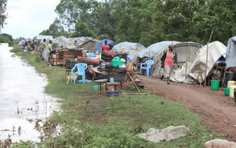
Many lives have been lost and properties damaged by the severe floods. Most people are displaced from their lands and the situation forces them to live in relief camps. Floods have adverse effects on health and health services in terms of disease outbreaks and the capability to reach people when roads are not passable. In most cases though people from affected areas move to relief camps where they cluster together. Such relief camps soon become slums creating social problems and unhygienic conditions, which are conducive for the spread of contagious diseases and sexually transmitted diseases. The congestion in the camps also poses a big health challenge in terms of communicable diseases. Flooding is associated with diseases such as malaria, typhoid and bilharzia. Often, women and young girls are the immediate sufferers of these situations. Livestock are weakened due to difficulties to access grazing grounds. Food shortages persist for a much longer time as the farming land remains underwater and is not possible to cultivate for up to 6 months.
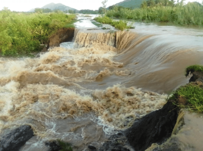
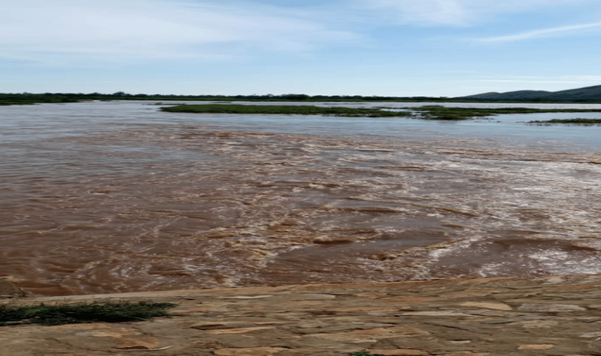
The wetlands of Busia County are at Budalangi area and Yala swamp area of Lake Victoria Drainage Basin. The areas are wet by rivers Nzoia and Yala, and they suffer a lot during the over flooding of these rivers. Human pressures, due to agricultural activities, as well as population increase, are a contributing factor to flooding in the areas. The concerns on land use and settlement trends affecting the communities in the areas indicate high levels of land degradation and land cover change, which means every vegetation, soil or water on the surface of the earth.
Lake Victoria has also had a big influence on the population in Budalangi with the main reason for settling in the area being fishing for livelihood. Most young women in the area are engaged in selling the fish catches leaving the aging population and children to take care of the farms. The high water table in the floodplain, especially during the wet season, renders the area inhabitable. The floodplain is only suitable for arable farming during the dry periods. The soils of the floodplain in the lower reaches of the Nzoia River are alluvial. The river meanders in the floodplain depositing silt during seasonal floods.
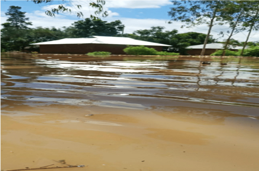
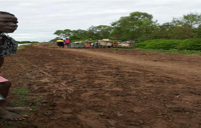
The major parts of the floodplain contain black cotton soils, while other areas have coarse textured sand silt mixture. In some places, there exist saline soils. The upper Nzoia Basin contains extensive seasonal swamp areas in the high and medium rainfall zones that are mainly utilized for grazing due to poor drainage. Once the river bursts its banks, the resultant flooding displaces close to 30,000 persons every rainfall season. People are usually evacuated to safer higher grounds during floods. Entire homesteads are swept away, property and crops worth hundreds of thousands of shillings are lost and many people perish as rivers break their banks, rendering large areas of land inaccessible The floods destroy the accumulated assets and settlements.
1. Population Pressure and Settlement Patterns
Settlement patterns have been partly influenced by population pressure. Most people settle on steep slopes as well as cultivation on that land also tends to increase the vulnerability of the community to landslides. This also increases the possibility of increased rates of soil erosion,particularly where overgrazing and deforestation have reduced vegetation cover.
2. Climate Change
Abundant precipitation can lead to disasters such as flooding, water pollution, soil erosion, dam breaks, and water-related disease outbreaks and famine. Furthermore,scarcity of precipitation in areas, which ordinarily receive it, can lead to drought, water scarcity, loss of vegetation, loss of livestock and wildlife, famine and general suffering of people living in the affected areas. It is important that the characteristics and predictive potential of rainfall are factored in all the water resources management practices and policies in order to mitigate the adverse effects of disasters in the water resources sector.
1.Property destruction- crops,livestock , assets and properties are destroyed. This throws the area into a season of food insecurity.
2. Displacement of people- due to houses being submerged in water people are forced to move out of their native land and settle elsewhere; mostly rescue camps.
3.Growth of slums and exposing individuals to health hazards- many people have to be converged in one rescue area they end up settling in those camps that eventually grow into slums. This puts the people in a state of getting air borne and water borne diseases.
As a youth who has interacted with friends from areas affected by floods, as well as reading in history over the same topic, I have several recommendations on what can be done to reduce the occurrences of floods or rather reduce effects in case they happen.
1.Prior Preparation- People living in such areas should have escape plans as well as put in place flood measures; flood barriers and shields that are temporary.
2.River banks barriers -should be strong and not easily destroyed by flow of heavy rains.3.New Settlements- it's only wise to have people be settled in safer
Effects from the rains have been observed as early as 7 April with the Kenya Red Cross Society (KRCS) responding with local resources to the minor emergencies since the onset. Since 16 April, the effects have worsened leading to displacements of population and livelihood disruptions, with the KRCS scaling up its response, especially in the provision of shelter services. The “Long Rains” currently being experienced have brought heavy rain and subsequent flooding to the counties of Tana River, Busia, Kisumu, Garissa, and Marsabit. Based on latest assessments from Kenya Red Cross staff and volunteers, the flooding has displaced a total of 4,493 households (26,958 people). At this time two deaths have been reported. Some of the displaced persons are hosted in makeshift camps and others hosted by friends and relatives. KRCS is coordinating with the local administration to set up displacements' camps. In addition, 3,232 acres of land with crops have been destroyed in the Tana River basin. (IFRC, 23 Apr 2021)
On 13-14 May, heavy rain was reported across western and southern Kenya, including Nairobi, triggering floods that have resulted in four casualties. The Kenya Red Cross reports that more than 400 houses have been destroyed due to floods in informal settlements in Nairobi. About 6,800 families have been displaced after houses have been reportedly flooded. On 13 May, River Endau and River Kipsangui (in western Kenya) broke their banks, causing floodwaters which damaged several settlements. In addition, several thousand households have been displaced and thousands acres of productive land has been destroyed in Tana River, Kisumu, Busia, Homabay, Migori and Baringo Counties. DG ECHO is supporting the provision of assistance to the affected households through the Kenya Red Cross. (ECHO, 17 May 2021)